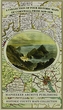
This folded map (890mm x 1000mm when unfolded) is an ideal souvenir for tourists to the County of Cornwall and also a valuable reference resource for local and family history research. It includes John Speeds map of 1610, Johan Blaue's map of 1648, Thomas Moules map of 1836 and the Plan of the...
číst celé
This folded map (890mm x 1000mm when unfolded) is an ideal souvenir for tourists to the County of Cornwall and also a valuable reference resource for local and family history research. It includes John Speeds map of 1610, Johan Blaue's map of 1648, Thomas Moules map of 1836 and the Plan of the City of Truro 1831 by Robert Dawson.
schovat popis


Recenze